
- 1自动驾驶技术的发展可以追溯到几十年前,但近年来得到了快速发展
- 2【ArrayList】JDK1.8源码详细注释 以及如何实现线程安全的链表
- 3Kafka + Kraft 集群搭建教程,附详细配置及自动化安装脚本
- 4看《韩顺平Java》视频的笔记
- 5以太坊私有链 搭建及相关操作_搭建以太坊私有链
- 6rabbitmq-常见七种消息队列-控制台界面管理-python-实现简单访问_rabbitmq 控制台
- 7linux中rabbitmq服务启动失败,linux系统RabbitMQ启动错误记录
- 8AutoDL算力租用,Mobaxterm+Pycharm+VScode通过SSH连接远程服务器AutoDL_如何出租自己的算力
- 9【网络】网络编程套接字(二)
- 10vscode添加gitbash终端(最新)_vscode里面添加git bash终端
R—Fans激光雷达三维PiontCloud2数据转二维LaserScan数据进行2D建图_registering first scan
赞
踩
本文所用的源码地址:https://github.com/ros-perception/pointcloud_to_laserscan.git
ROS官网的说明: http://wiki.ros.org/pointcloud_to_laserscan
激光SLAM算法种类比较多:
其中就不乏人们所常用的:Hector,Karto,gmapping,cartographer;其中Hector算法只需激光雷达就能建图,给没有里程计的小伙伴带去福利(我也是迫于此),建图效果也是依次递增的;我此次使用的激光雷达是北科天绘的R—Fans的16线激光雷达,官方自带的驱动是两个计算node,如下图,
最终得到使用的是/rfans_driver/rfans_points话题,此话题类型sensor_msgs/PointCloud2,为三维的点云数据,而上面的算法的输入都是二维的sensor_msgs/LaserScan这就需要我们增加一个新的ROS节点来订阅sensor_msgs/PointCloud2类型的/rfans_driver/rfans_points话题,然后发布一个sensor_msgs/LaserScan类型的/scan话题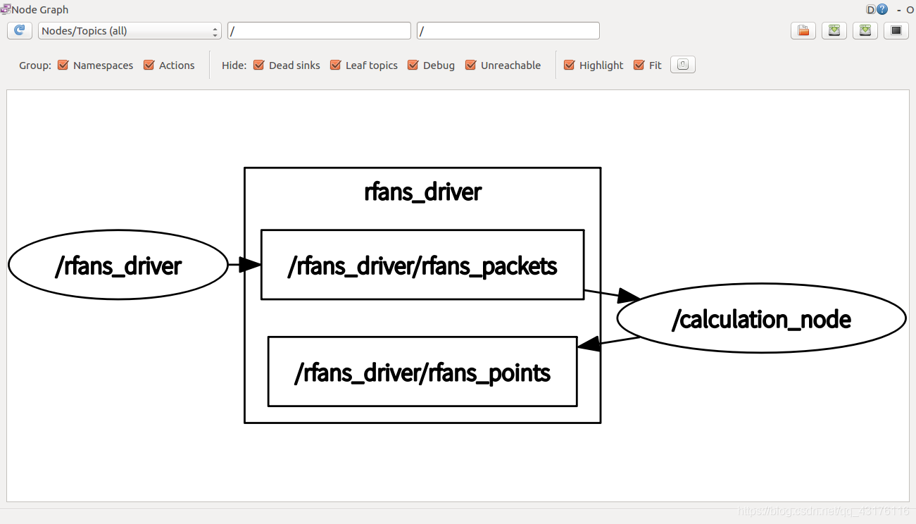
pointcloud_to_laserscan包
包里有两个cpp的node对应的两个launch文件,我只用到了sample_node.launch对应的节点为pointcloud_to_laserscan_node
launch文件需要修改:
  <?xml version="1.0"?>
    <launch>
         <!-- run pointcloud_to_laserscan node -->
        <node pkg="pointcloud_to_laserscan" type="pointcloud_to_laserscan_node" name="pointcloud_to_laserscan">
            <remap from="cloud_in" to="/rfans_driver/rfans_points"/>

           <rosparam>
                transform_tolerance: 0.01
                min_height: 0.0
                max_height: 1.0

                angle_min: -3.14159 # -M_PI/2
                angle_max: 3.14159 # M_PI/2
                angle_increment: 0.0087 # M_PI/360.0
                scan_time: 10
                range_min: 0.05
                range_max: 30.0
                use_inf: true
                inf_epsilon: 1.0

                concurrency_level: 1
            </rosparam>
        </node>
    </launch>

- 1
- 2
- 3
- 4
- 5
- 6
- 7
- 8
- 9
- 10
- 11
- 12
- 13
- 14
- 15
- 16
- 17
- 18
- 19
- 20
- 21
- 22
- 23
- 24
上面的参数修改之处可以对照github源码主要的一处改动就是:
<remap from="cloud_in" to="/rfans_driver/rfans_points"/>
改为你自己的三维点云数据topic
今后在你启动激光雷达之后启动此launch文件或将此launch文件include到激光雷达启动文件里面就能完成数据的转换,中间的rosparam参数可以自己根据要求自由改动以更加适合自己的需要。
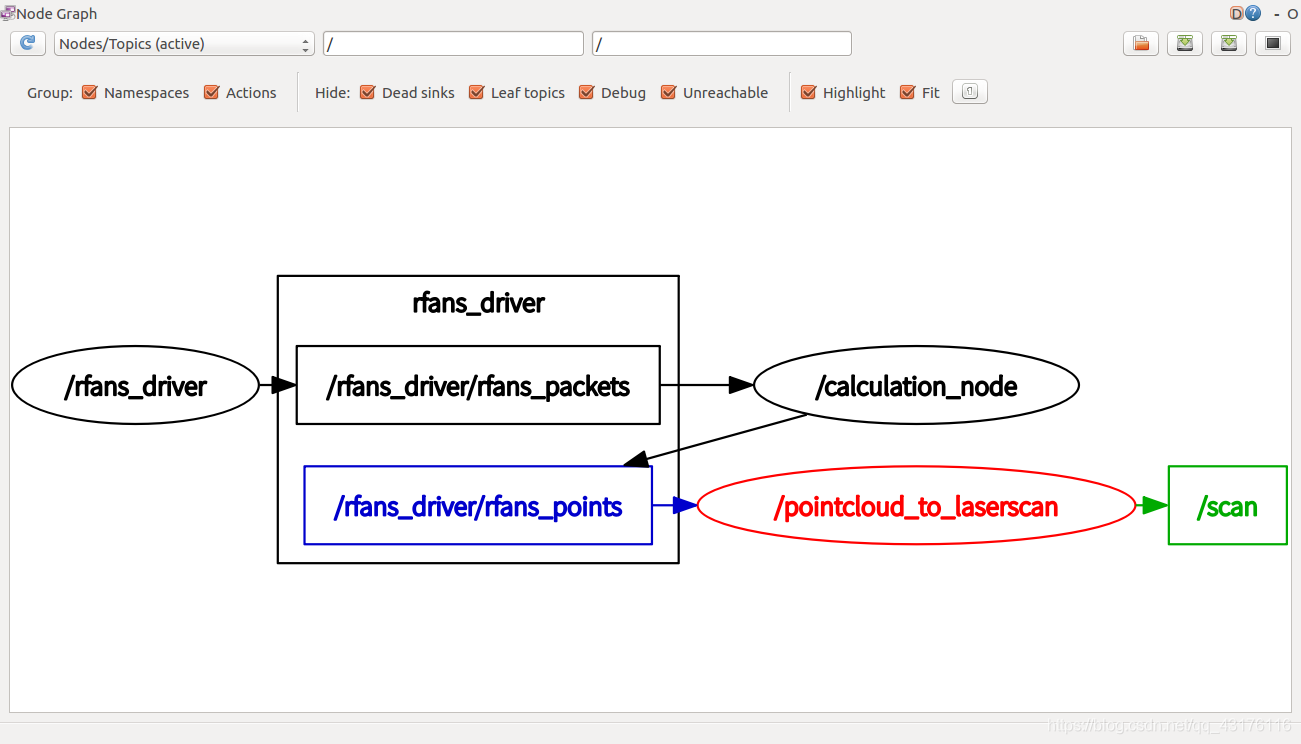
附上加入转换节点后的计算图:
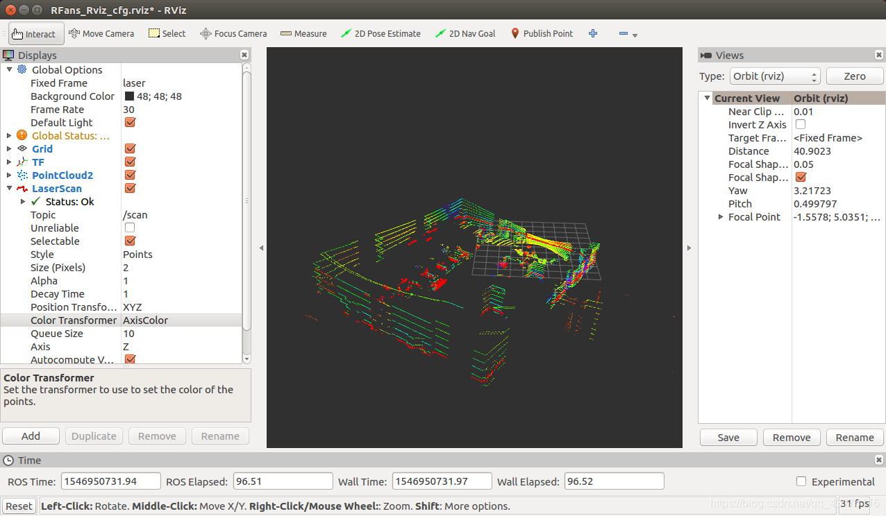
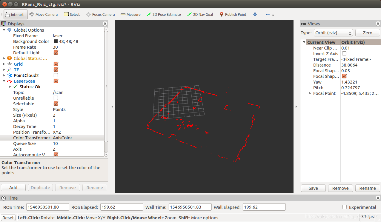
以及rviz的显示图:
我的下一文将介绍利用hector建立2D地图,场地为实验室。
note:
在使用pointcloud_to_laserscan将多线激光降为1线时,程序里面发布的topic(/scan)是没有时间戳的(header.stamp)所以在跑gmapping时出现 slam_gmapping stop in Registering First Scan problem也就是注册第一帧后程序不动了,然后rviz里面的地图也不更新,然后我找到、scan消息发现无时间戳,遂在pointcloud_to_laserscan_nodelet.cpp程序里面加上一句
output.header.stamp = ros::Time::now()
- 1
即可顺利建图。
你问我为什么要用16线激光建2维图?实验室太穷只有多线而无1线,只能勉强降低身份。
你问我建图效果咋样?其实除了容易出错,我目前发现还是差不多,缺点就是扫描频率相对40Hz的要求还是达不到,所以hector_slam旋转时容易跑偏,其他的都还不错。

